

RTRS Maps
Committed to the conservation of biodiversity
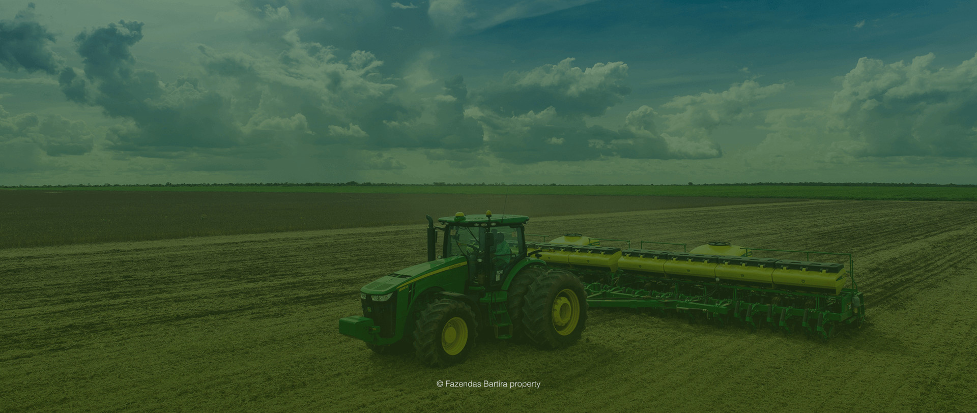
RTRS has developed its zoning tool to guide the expansion of soy farming and promote ecosystem conservation. This initiative was carried out jointly by producers, the industry and civil society organizations, both regional and international.
The project was supported by:


How to analyze RTRS Maps?
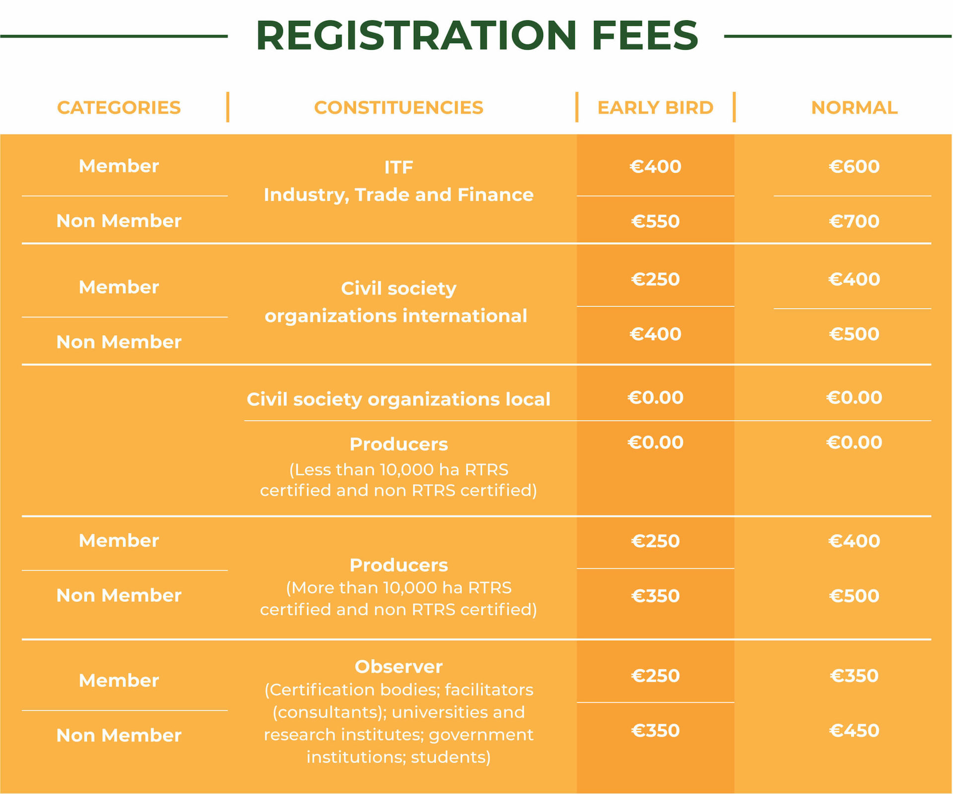
The maps can be used as guides when analyzing the following categories:
Category I Areas
Areas with critical biodiversity hotspots. Stakeholders agree that conversion of native vegetation into responsible soy production should not occur.
These areas are therefore designated as non-certifiable, except in cases where producers can reliably demonstrate that the area was cleared prior to May 20091.
Category II Areas
Areas of great importance to biodiversity. Pursuant to version 2.0 of the Standard, soy expansion in these areas can only occur after an assessment of High Conservation Value Areas (HCVAs) to identify areas for conservation and areas where expansion can take place. Version 3.0 of the Standard states that conversion without an HCVA assessment is only allowed until June 2016. Conversion of natural lands is forbidden as of June 2016.
Land legally converted by June 20162 is certifiable. Conversion of natural lands is forbidden as of June 2016.
Category III Areas
Areas where the existing legislation is suitable to control the expansion of responsible by June 2016 (these are often areas of great relevance to agriculture, but not to conservation). Conversion of natural lands is forbidden as of June 2016.
Land legally converted by June 20162 is certifiable. Conversion of natural lands is forbidden as of June 2016
Category IV Areas
Areas already used for agriculture where there is no remaining native vegetation (except in legal reserves) and, therefore, no expansion. Conversion of natural lands is forbidden as of June 2016.
Land legally converted by June 20162 is certifiable. Conversion of natural lands is forbidden as of June 2016.
Notes:
Due to the regional scale of the Maps (1: 250,000 or 1: 500,000), their use as guidance tools does not preclude in-farm scenarios that can be used by producers to check whether the RTRS Standard requirements on expansion are being met. In Category 3 and Category 4 areas, unmapped scenarios can be found within the properties (e.g. small wetlands, areas of cultural value, etc.) because of scale or other factors.
(1) In Category 1, producers can demonstrate that properties were converted before May 2009 using verifiable tools and / or combinations thereof (e. g., high-resolution images showing that the change took place before 2009, pre-2009 land use maps, planting services invoices, bills of lading or delivery documents stating the property as the point of origin, etc.).
(2) In Categories 2, 3 and 4, producers can demonstrate that properties were converted before June 2016 using verifiable tools and / or combinations thereof (e. g., high-resolution images showing that the change took place before 2009, pre-June 2016 land use maps, planting services invoices, bills of lading or delivery documents stating the property as the point of origin, etc.).
Learn more about map development in each country
RTRS Maps are the result of a multi-stakeholder process spearheaded by technical groups from each country. As part of a fully participatory process, technical groups
in each country set criteria used to classify lands into the four categories established in the RTRS Standard for Responsible Soy Production
Brazil
Argentina
Paraguay
The project started in February 2012 with the creation of a technical group and an advisory group. By an open call from RTRS Project Manager, participants for both groups were recruited
from networks and contacts from partner organizations and finally selected by academic / professional experts on project-related topics and by RTRS.
Participants


Consultants